
Upon leaving the parking lot, the terrain is relatively gentle as the trail finally connects to the John Muir just beyond the crossing of the Dana and Lyle Forks of the Tuolumne River. Once across, the trail climbs somewhat steeply for the next mile or so where it levels off and moves in and out of the forest. Views out along this stretch of trail are limited.

As the creek became audibly noticeable, we moved off of the trail heading towards the creek and found this wonderful spot where two small waterfalls dropped into this shallow pool. Would be a prefect spot for an impromptu dip or an early lunch, which is what we did.

Walking from the pool towards the trail, we spotted a mule train taking supplies up to Vogelsang. The High Sierra Camp is supplied twice a week with food for the camp, hospitality needs and mail for staff.

Roughly paralleling Rafferty Creek, the sound of water moves in and out of the audible environment. Occasionally, the trail abuts or crosses the creek providing both a visual and sensorial delight. Wildflowers abound in season and on this particular trip were everywhere.

There is a second stretch of the trail where there takes a steeper incline for roughly a half mile. or so. After that it more of a constant incline. Further up the trail, our first glimpse of Mt.Fletcher (11,408 ft.) meant that we were nearing Volgelsang which sits directly below the peak.

After nearly 6 miles of continuous uphill trekking, we reach the top of the watershed where the trail spits in a number directions. Our destination lies roughly a mile further up the road.

As the sun began to fall, we reached our destination and home for the next three nights. Permanent facilities include the kitchen, parts of the dining hall, a storage / cleaning area (formerly showers) and the restrooms. There is also a stable area for horses and mules. The tented cabins (4 people to a cabin) are seasonal which in the case of 2011, lasted 5 weeks.


The first day hike was up to Voglesang Pass (10,700 ft.). Partially up the trail from the camp, an interesting view of the eastern side of Half Dome became visible. This was also a spot where cells phones could catch a signal. The San Juaquin Valley lies in the distance.

Moving along the trail pass Vogelsang Lake, the trail wound it’s way up towards the rocky ridge associated with Vogelsang Pass.

Nearing Vogelsang Pass, the terrain became very rocky with patchy remnants of last winter’s snowfall remaining as reminders of a very wet winter. My fellow trekker (and wife) adds scale to the rock field.

The top of the pass provided a panoramic view of the headwaters of Lewis Creek. Mt. Florence (12,561 ft.) lies beyond to the east along the crest of the Sierra Nevada. That meadow below was so inviting but that would be a trek for another day. This portion of the trail also takes you down to Yosemite Valley via Merced Lake is one is so inclined. Perhaps on another day!


The next days hike involved a trek to Townsley Lake; a water body that people characterized as a real jewel. The trail starts off from the camp and heads north via an alternative route back to Tuolumne Meadows that passes through Lyell Canyon. Climbing towards a ridgeline, we see what appears to be an opening in the tree cover at the base of Mt. Florence that we believe to be the lake. Scrambling over rocks and through trees, we climb up over a ridge past a small waterfall and come upon the lake, and it is everything that we imagined it would be.


After spending some time on the shores of the lake, we head north cross-country towards Evelyn Lake. Scrambling upward through boulder fields and trees, we were surprised to come upon a large plateau hosting an abundance of small pools and lots of wildflowers. d As the plateau was for the most part treeless, we were afforded open views in all directions. It also looked like really good bear country but all we saw was what appeared to be mountain lion scat. We continued to head north across the plateau towards Evelyn Lake where we could connect with the trail and head back to camp.


At the north end of the plateau, we spotted Evelyn Lake and the trail below. We picked a route that followed the contours as best as we could to minimize the ups and downs. One of the first things we saw when we connected with the main trail was a lone ranger riding towards the High Sierra Camp at Vogelsang. Looked like something out of the old west.

Heading down into a canyon towards the camp, we had no idea that we were about to experience one of the best displays of wildflowers I have ever seen in the Sierras. It was truly a photographers and botanists dream. It's no wonder that famous landscape architects such as Lawrence Halprin sought inspiration in nature for much of their urban design work. Halprins early water works projects in Portland and Seattle are good examples of trying to capture what nature does and apply that to urban landscapes.


Our second day of hiking had been really inspirational both as a photographer and landscape architect. We settled back down in camp and watched the sun set on the face of Mt. Florence as night descended upon us amidst an endless array of evening stars.


Night had fallen and the next day would find us on our way back to Tuolumne Meadows and home to Sacramento.
 Sedona from high up Airport Road.
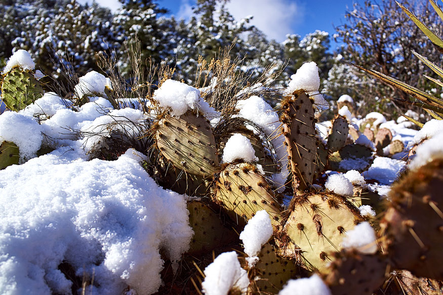 Snow amongst the cactus.
 Sculpture covered in snow in town.
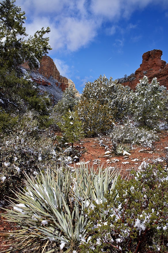 Desert snowscape.
 Flautist on top of a rock.
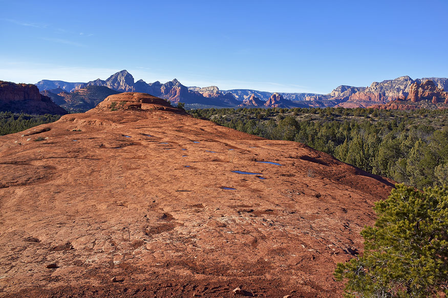 Distant view of Sedona from high up Horsethief Canyon. By now most of the snow had gone.